

Crooked Lake
Current Situation
In June of 2026, the Water Security Agency (WSA) sent several communications to the Crooked Lake area indicating an operation with a mobile crane to install stoplogs was going to be completed.
After significant rainfall in the area, the operation was never completed as inflows were well above normal and kept the lake at a higher level without needing to install stoplogs. Operational plans like this are flexible and can change based on several factors, with weather conditions having the largest impact.
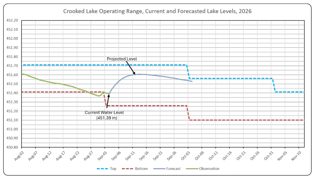
Given the weather conditions, WSA did not install stoplogs this fall. With water levels reaching the lower end to the operating range, WSA has now decided to install the stoplogs to increase and maintain fall lake levels. This decision also addresses concerns raised by recreational users around Crooked Lake regarding removing boats and other watercraft from the lake.
On Sept. 3, 2026, WSA will be installing stoplogs using a mobile crane. Installing the logs will keep the lake closer to normal levels for this time of the year and support users around the lake. Going forward, WSA will continue to monitor conditions and assess future operations considering the fall operating range and structural considerations.
It is still important to note that recent inspections have shown that the dam structure which helps manage lake levels has deteriorated further, limiting the ability to respond quickly to changing conditions. Given the current state of this infrastructure, WSA can only implement temporary and short-term operating measures to control Crooked Lake’s water levels. WSA is looking forward to working in collaboration with stakeholders and rights holders to build a new structure, which is our path forward to managing water levels.
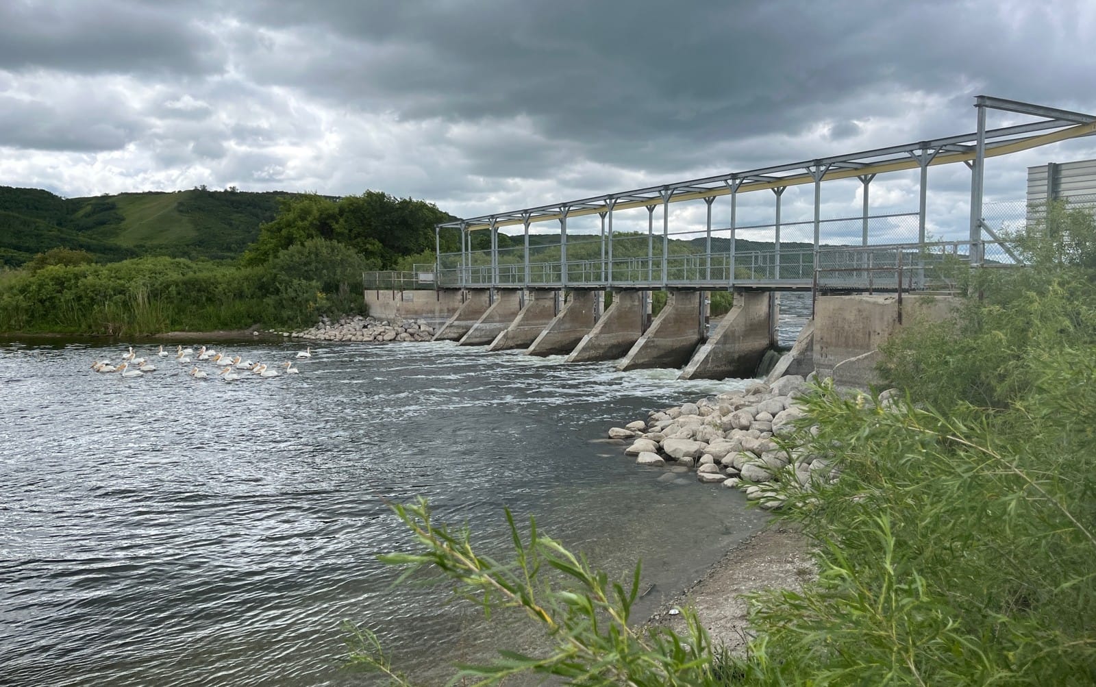
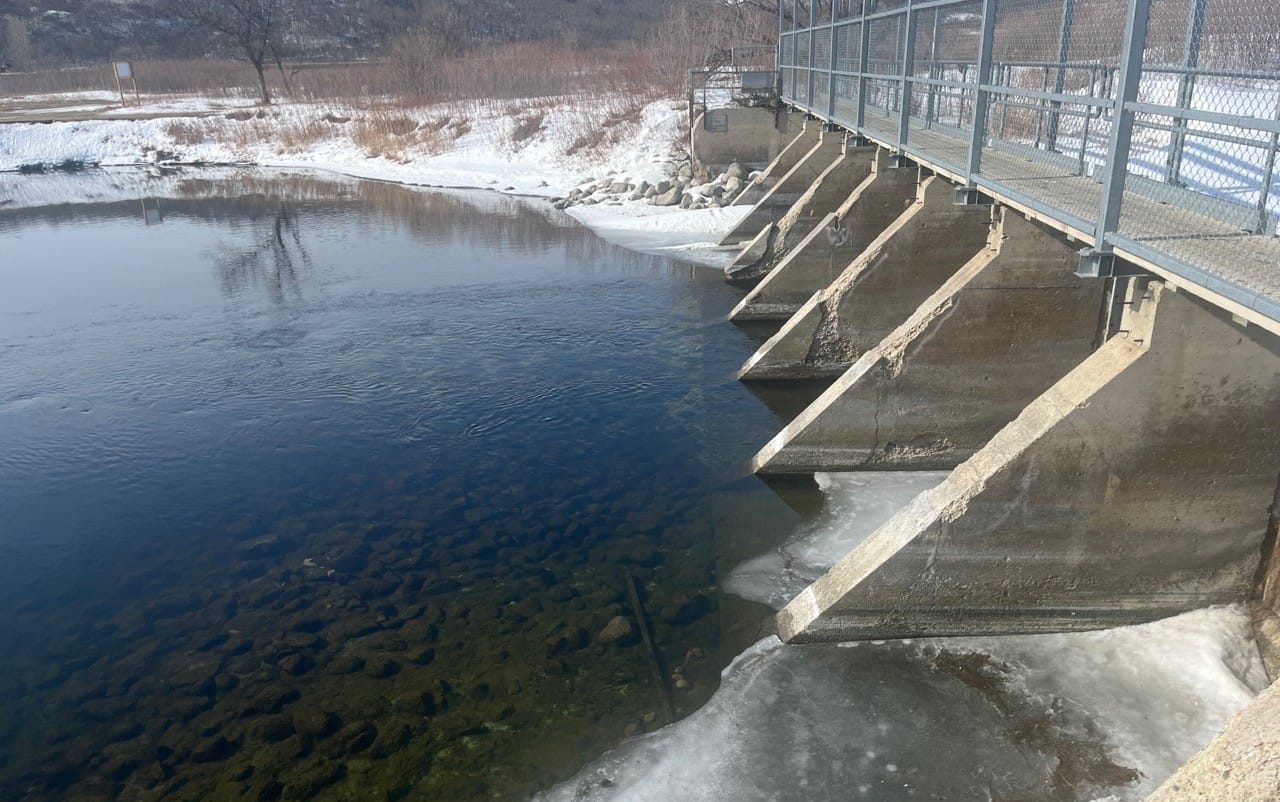
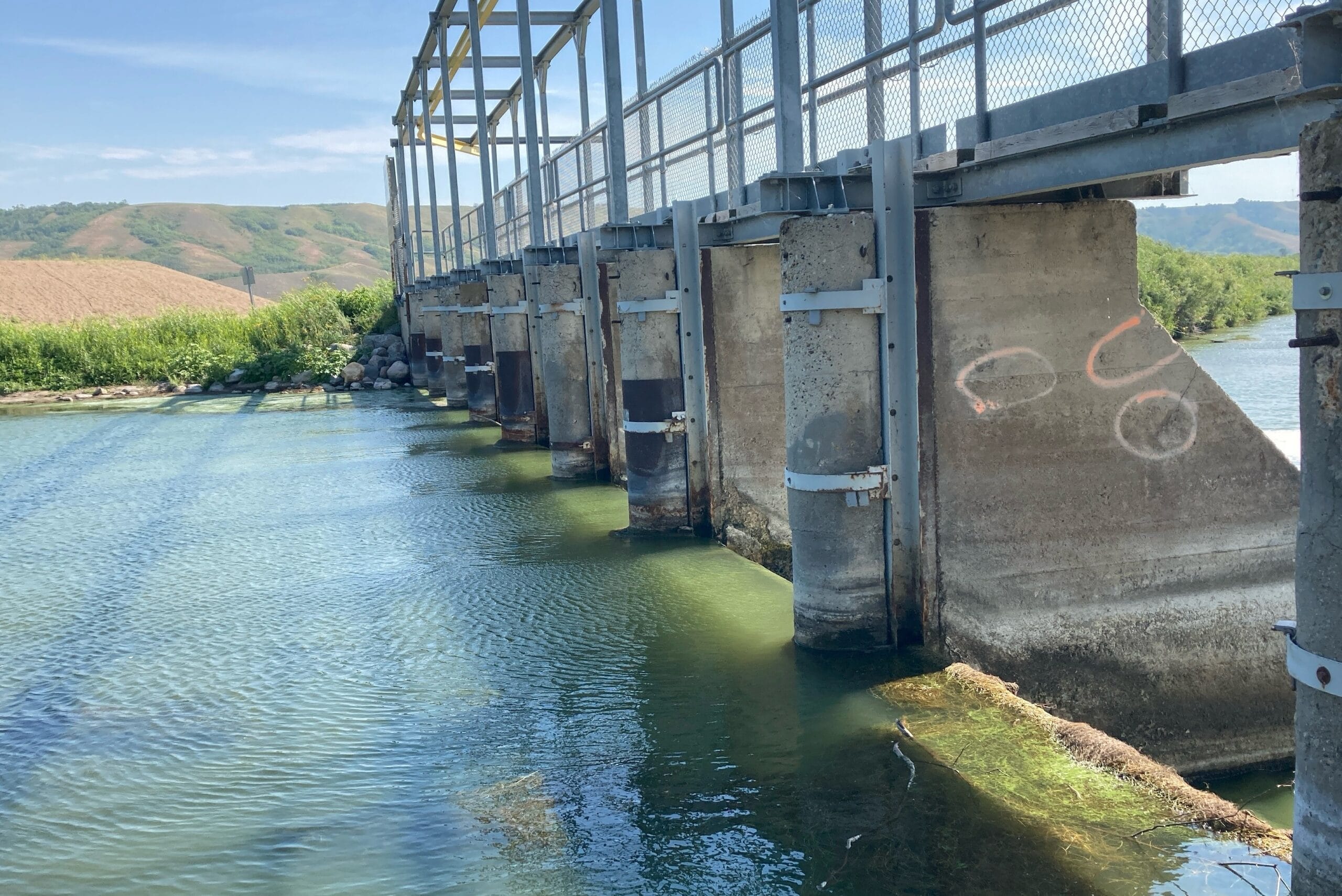
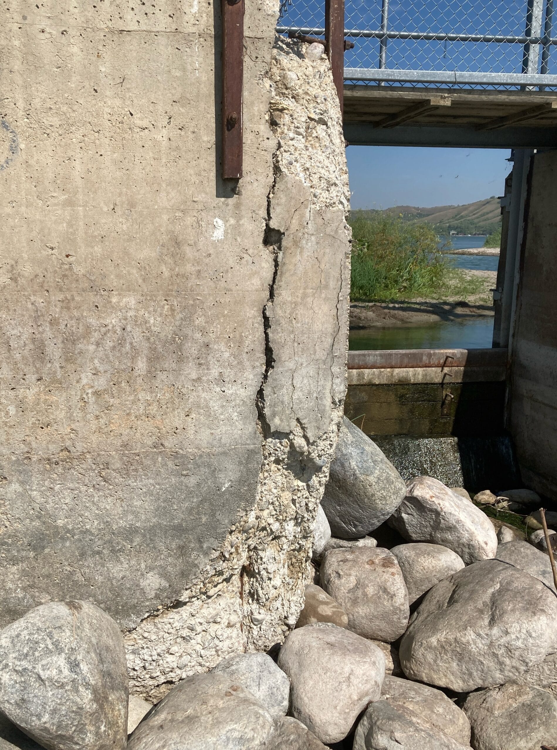
Built in 1943, the Crooked Lake Dam has surpassed its original design life and is slated for a full replacement. A new design is finished with some site preparations already complete. Efforts to secure land around the proposed site have been ongoing since 2015.
For the project to proceed, WSA needs the federal land control issues in the area resolved. Once land control and consultation requirements are resolved, the replacement structure is fully designed and ready to proceed to construction.
Crooked Lake – Frequently Asked Questions (FAQ)
What water level can be expected this fall?
- The Crooked Lake water level on Sept. 2, 2026, was approximately 451.39 metres above sea level (m).
- WSA’s current operation is targeting normal September levels of ~451.6m which is close to the top of the operating range and ~ 0.2 m higher than last year at this time.
- Water levels are expected to be near normal levels for the remainder of the month.
- Inflows into the lake continue to be well above normal for this time of the year and are expected to remain above normal into the fall.
- The lower limit of the approved Normal Operating Range decreases to 451.26 m on September 1 as part of the normal seasonal operating schedule.
How does WSA manage lake levels now if the structure is in bad shape?
- The current condition of the concrete piers is preventing the use of the built-in monorail system that would normally be used to help manage lake levels.
- A mobile crane is needed to install or remove the stoplogs used to increase or decrease outflows from the lake.
- A crane cannot be used during high winds and mobile crane operations carry considerable safety risks.
- Additionally some bays are no longer in use for safety reasons reducing the ability of the structure to pass flow.
Why is the water level declining?
- Water levels naturally decline during late summer and fall as runoff decreases and evaporation continues.
- Although inflows to Crooked Lake have remained higher than normal throughout much of 2026, inflows are gradually decreasing from the elevated levels experienced earlier in the season.
- The recent decline in lake level is consistent with seasonal conditions and is expected to continue through September before normal fall operations upstream cause water levels to increase again.
Will lower water levels affect boating and recreation?
- Some recreational users may notice reduced water depths near shorelines, boat launches, and boat lifts as lake levels decline.
- Boat owners may wish to monitor local conditions and plan removal of boats and lifts accordingly.
- While some recreational impacts may occur, Crooked Lake has operated at similar elevations in previous years.
- WSA will continue monitoring conditions and communicating any significant changes to expected lake levels.
Why isn’t WSA trying to maintain the lake near the middle of the operating range?
- The approved operating plan establishes a Normal Operating Range rather than a single target water level.
- Water levels naturally fluctuate within and around the operating range due to changing inflows, weather conditions, and operational constraints.
- The operation is targeting median levels for this time of the year; fluctuations in the levels could still occur due to changes inflows and weather events.
What is the issue with the Crooked Lake control structure?
- The Crooked Lake control structure was constructed in 1943 and has exceeded its original design life.
- Recent inspections identified further deterioration in portions of the concrete structure.
- As a result, the integrated monorail system used historically to install and remove stoplogs can no longer be safely utilized.
- All stoplog operations now require the use of a mobile crane.
What is being done to address the aging structure?
- WSA has completed planning and design work associated with replacement of the Crooked Lake control structure.
- Replacement of the structure remains dependent on completion of stakeholder engagement activities and required land agreements.
- For the project to proceed, WSA needs the federal land control issues in the area resolved.
- Once land control and consultation requirements are resolved, the replacement structure is fully designed and ready to proceed to construction.
Will there be more operations this fall?
- WSA will continue monitoring lake levels, inflows, weather conditions, and forecasts.
- Significant unforeseen changes in conditions would be evaluated if they occur.
- WSA continues to monitor the condition of the existing structure and evaluate operational decisions accordingly.
- WSA will be planning to remove the stoplogs in October of 2026.
Will this affect downstream users?
- WSA does not currently anticipate significant impacts to downstream users because of the approved fall 2026 operating plan.
- WSA will continue monitoring conditions throughout the fall and will communicate any significant changes if necessary.
An Experienced Team
We love our Saskatchewan waterways, and we also know a lot about them. If you need help finding information or determining if your shoreline or water-related project needs a permit, we can help! Use the contact form or give us a call to get started.